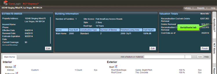
Aerial images of the property can be viewed by selecting the AerialAssist tab in a valuation.
To view Aerial Images:
-
On the valuation page, click the AerialAssist tab (the property address must be complete).
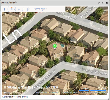
Example image:
-
Once the image is displayed, manipulate view angles, or zoom levels, etc.
AerialAssist Controls:
The Aerial Assist controls from left to right are:
- Rotate Left
- Pan in any direction
- Rotate Right Zoom Out or Zoom In
- Birds eye drop-down menu. Select to view a standard road map view, an automatic view that switches to the best map style as you zoom, or a bird's eye view for a better angle of aerial photography.
Was this topic helpful?
Click "No" to send our RCT documentation team an email.
YesThank you!
No